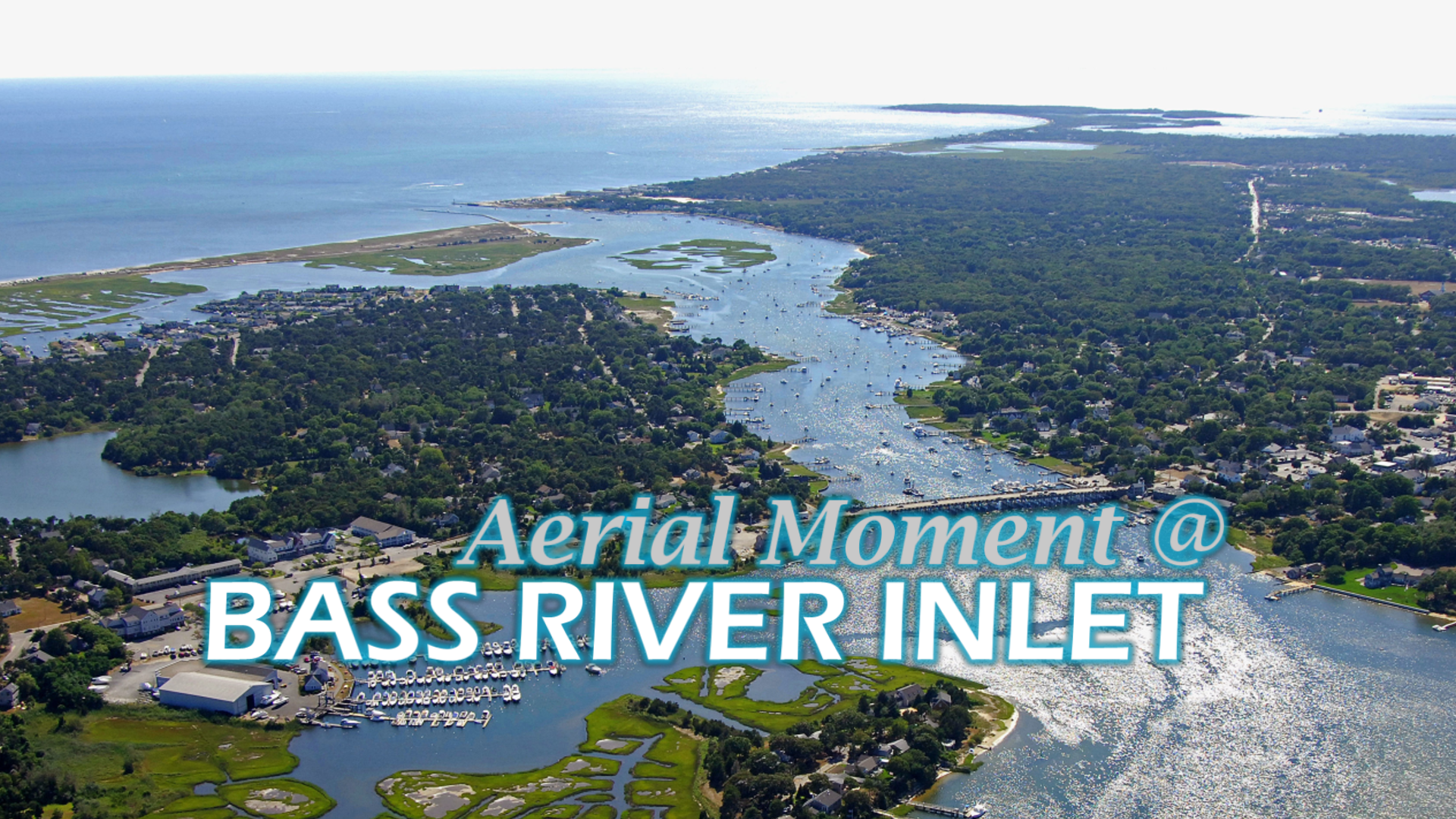
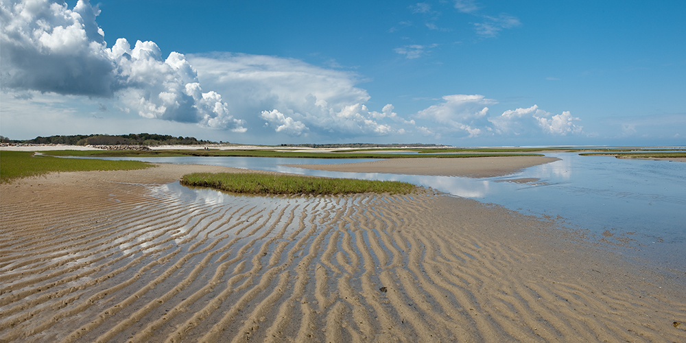
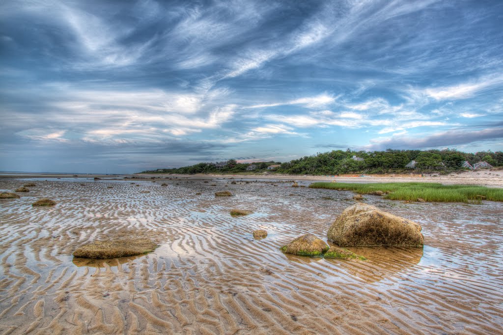
The Bass River inlet is a tidal estuary in the village of South Yarmouth on Cape Cod. It separates the towns of Dennis and Yarmouth and has a brackish flow that winds its way toward Follins Pond.
Help us grow. Keep up with our Cape Cod video series


Washashore Travel Tips and Advice for Life on Cape Cod

The Bass River inlet is a tidal estuary in the village of South Yarmouth on Cape Cod. It separates the towns of Dennis and Yarmouth and has a brackish flow that winds its way toward Follins Pond.
Help us grow. Keep up with our Cape Cod video series

Hope you liked our video. Appreciate the Rumble votes. Please support our growth and Subscribe to our Channel so we can register a custom Channel name. Thank you!

Have you found the secret of Skaket Beach? Take a moment and watch our favorite sunsets and find your Moment of Zen on Skaket Beach in Orleans, Cape Cod.
Low tide fun at Skaket Beach in Orleans. This fine sand beach offers warm water swimming and is great for long strolls on the flats at low tide.
Skaket Beach is a great beach for socially distant calm, gentle beauty and family fun.
It’s not a swimmers beach. It’s a walking beach, a dipping beach, a walk forever out into the ocean beach. During high season it’s wise to get there early to avoid being turned away.
It is apparently one of the Go-to spots on the Cape to watch the sun disappear into the western sky. A perfect photo every sunset.
Help us grow. Keep up with our Cape Cod video series

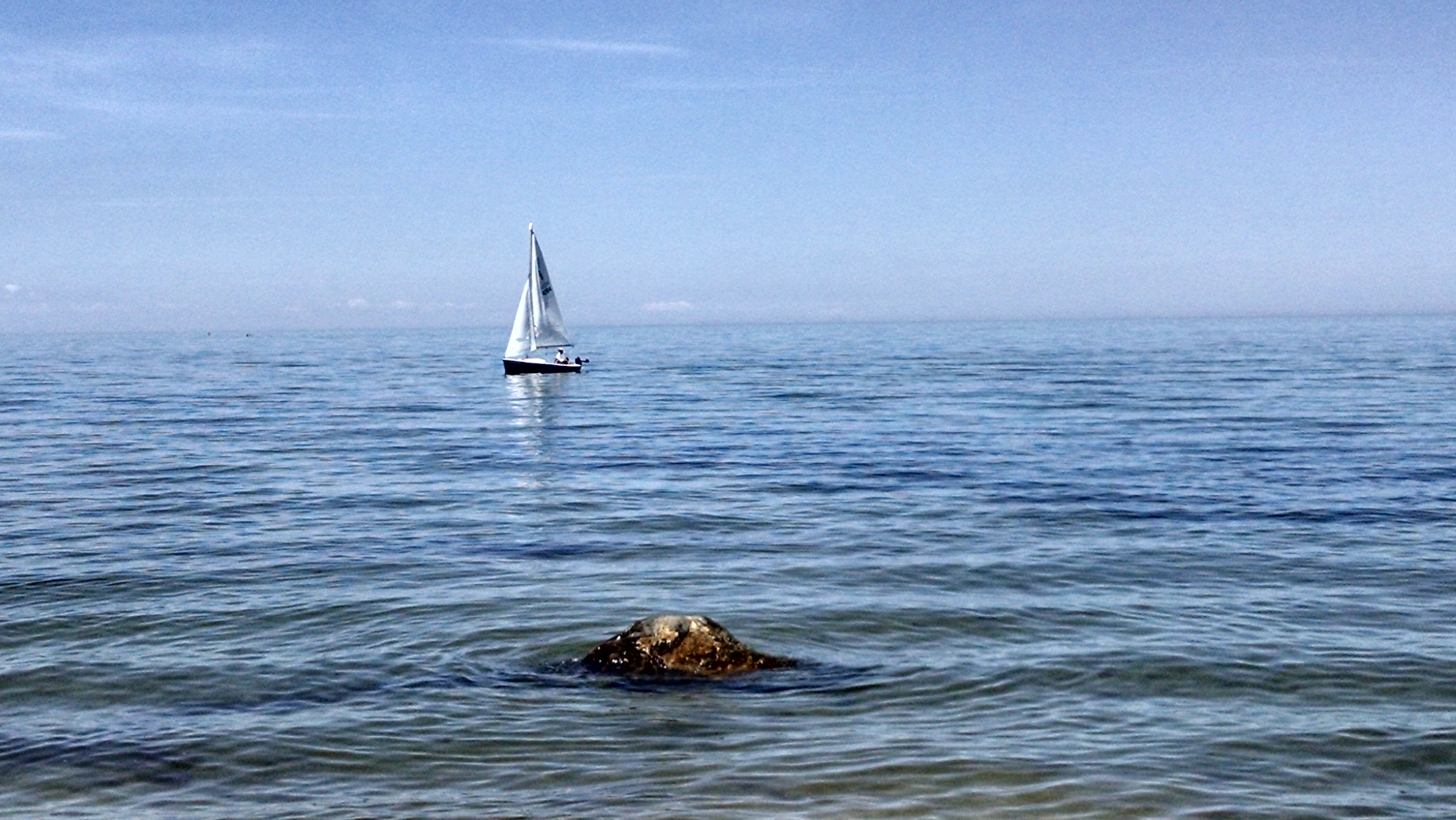
Bass River is an estuary and village in South Yarmouth, Massachusetts, United States. The estuary separates the towns of Yarmouth and Dennis at the central, southern sections of the towns. At its widest and most southerly point, it opens to and meets Nantucket Sound.
Bass River Beach or as it is commonly know, “Smugglers Beach”, is a quiet, restfull beach. There is a walkway and fishing pier to stroll on and enjoy the sights and sounds of the ocean.
Help us grow. Keep up with our Cape Cod video series
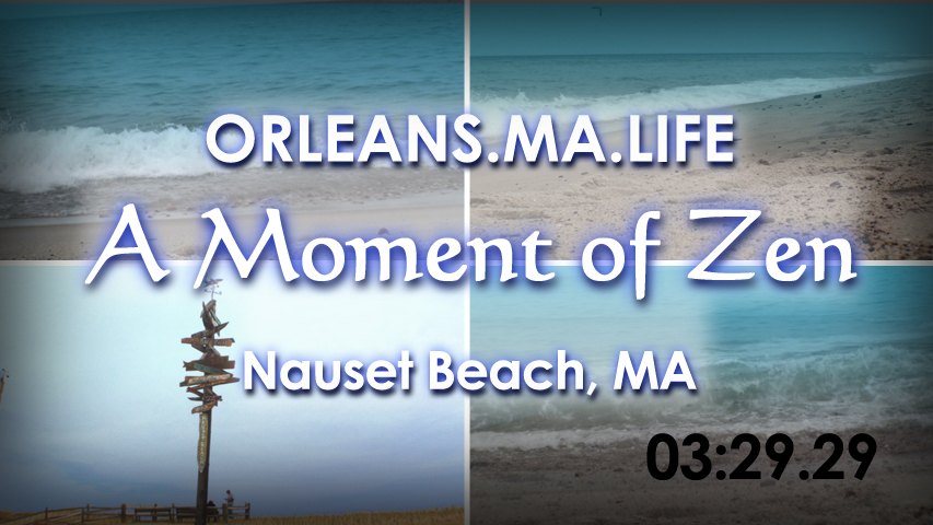
Have you ever seen the natural seal predation by Cape Cods famous Great Whites? Here’s a video during high season while we listen to the sounds of the Atlantic along Nauset Beach in Cape Cod.
Relish the taste of the ocean air, the sound of the breaking surf, and simply the best view on Cape Cod. Nauset Beach is a public beach inside the Cape Cod National Seashore Beach on the east coast of outer Cape Cod in Orleans, Massachusetts.
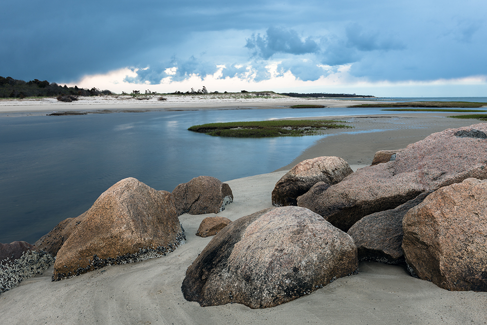
Nauset extends south from a point opposite Nauset Bay to the mouth of Chatham Harbor. Nauset Light Beach consists of a broad, sandy beach that is contained by a steep glacial scarp behind it. The cliffs provide a superb view of the great outer beach and the ever-changing sea.
Warm enough to walk barefoot along the water’s edge, but quiet enough to enjoy the sound of the ocean, the shore can offer some of the highest waves on Cape Cod. It is popular with swimmers, surfers, boogie boarders and fishermen.
Avoiding large schools of fish when swimming, and steering clear of seals or murky waters with low visibility is advisable and always swim, paddle or surf in a group.
Shark sightings are nothing new for Cape Cod, which has a reputation as a hot spot for white sharks. There have been several shark attacks on Cape Cod beaches in recent years, including a fatal one in 2018, when a 26-year-old man died after he was attacked by a shark at Newcomb Hollow Beach in Wellfleet.
It was the first fatal shark attack in Massachusetts since 1936. Unlike the shark featured in the 1975 film “Jaws,” great white sharks don’t intentionally target humans. But sharks can mistake swimmers for seals, their natural prey, and Cape Cod’s seal population has been flourishing under federal protections.
Nauset Beach in the fall is the perfect time to visit. During winter months, the beach profile is considerably lowered, sometimes exposing features such as the brick foundation of one of the earlier Three Sisters lighthouses.
There is not enough parking, but you can drop off the family and then ride to the beach. The beach is wide and if you’re willing to walk, can always find a private section of sand.
Help us grow. Keep up with our Cape Cod video series
The below images are copyrighted.
No works should be duplicated for any commercial usage without prior authorization by the artist.
Please consider supporting our efforts to capture the beauty and charm of the Cape.


All images on this site are copyrighted. No works should be duplicated for any commercial usage without prior authorization by the artist.
Learn More
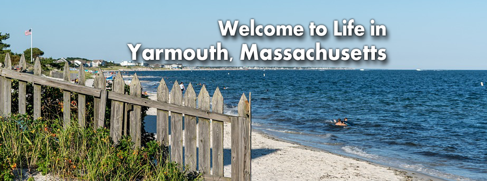

Yarmouth is named after Great Yarmouth, a town in the county of Norfolk, on the east coast of England, which is itself at the mouth of the River Yare.
Though none of the initial settlers hailed from that English town, the name was possibly chosen because across the North Sea from Yarmouth is the Netherlands, where a portion of the Mayflower passengers had lived in exile.
This group of pilgrims arrived back in England via the port of Yarmouth before heading to the New World.
In 1642 and 1645, Yarmouth furnished soldiers for the Plymouth Colony’s expeditions against the Narragansett.
In 1648, the Plymouth Colony’s legislature, the General Court, appointed Myles Standish to adjudicate land disputes among the Yarmouth settlers.
Yarmouth soldiers served the Plymouth Colony in King Philip’s War: fifteen Yarmouth men participated in the Great Swamp Fight without casualties, but the town did lose five men at Rehoboth.
Yarmouth troops also saw service in the early years of King William’s War.
In the early eighteenth century, some of the Yarmouth veterans of King Philip’s War were granted lands to settle in Gorham, Maine.
Developers began to refashion Yarmouth into a summer resort near the end of the nineteenth century.[42] Hotels and summer cottage communities proliferated in the first half of the twentieth century, particularly along what is now Route 28.
With the emergence of the car culture in the years just after World War II, these were joined first by many motels (mostly along Route 28 in West Yarmouth) and later by the denser, suburban pattern of residential housing construction that characterizes Yarmouth today.
The town’s southern shore is known for its beaches, from the west jetty of the Bass River to Great Island, on the east and south sides of Hyannis Harbor. The town has no state forests or wildlife management areas, although there are many such natural, unprotected areas in town.
Yarmouth is an absolutely picturesque beach town that can fit the lifestyle of just about anyone, especially Conservatives, Independents and Libertarians. One of the best thing about South Yarmouth is its location on the Cape being 15 minutes to Hyannis and 20 to Chatham.
View our official Yarmouth community page at Yarmouth.MA.Life

 Wellfleet is a town in Barnstable County, Massachusetts, United States, and is located halfway between the “tip” and “elbow” of Cape Cod.
Wellfleet is famous for its oysters, which are celebrated in the annual October Wellfleet OysterFest. In fact, Wellfleet’s oyster beds drove the early economy, as did whaling and fishing.
The town was home to 30 whaling ships at the time of the American Revolution. Because of the decline of whaling and the mackerel catch in the late 19th century, the fleet declined, being completely free of schooners by 1900.
The oyster fleet continued, however, and many types of shellfish continue to be harvested. Despite this decline, a church near the town center continues to operate a clock that chimes ship’s time.
The area was originally settled by Europeans in the 1650s as Billingsgate (after the famous fish market in East London). Wellfleet was part of neighboring Eastham until 1763 when it achieved town status after nearly 30 years of petitioning.
In 1717, the pirate “Black Sam” Bellamy was sailing nearby when his ship, the Whydah, sank offshore, together with over 4.5 short tons (4.1 tonnes) of gold and silver and all but two of its 145 men. The wreck was discovered in 1984, the first of only two confirmed pirate shipwrecks ever to have been discovered.
Guglielmo Marconi built America’s first transatlantic radio transmitter station on a coastal bluff in South Wellfleet in 1901–1902. The first radio telegraph transmission from America to England was sent from this station on January 18, 1903, a ceremonial telegram from President Theodore Roosevelt to King Edward VII. Most of the transmitter site is gone, however, as three quarters of the land it originally encompassed has been eroded into the sea. The South Wellfleet station’s first call sign was “CC” for Cape Cod.
In 1961, President John F. Kennedy created the Cape Cod National Seashore, which encompasses most of the Atlantic shoreline of Cape Cod. In Wellfleet, the territory circles the town, from Jeremy Point through the marshes and “islands” along the Herring River, includes Cahoon Hollow Beach, and extends the length of the Atlantic shore of the town.
The lands of Wellfleet wrap around Wellfleet Harbor, extending from the main portion of the Cape around the harbor to Jeremy Point. At one time, Wellfleet Harbor included an island known as Billingsgate Island, which sat at the harbor’s mouth, to the south of the point.
Once a flourishing small community with a lighthouse, the island was destroyed by coastal erosion and now exists as a shoal that is exposed at low tide. The Billingsgate shoals are split between Wellfleet and neighboring Eastham.
Several other inlets extend inland from the harbor, at the mouth of the Herring River (also called “The Gut”), Duck Creek, Blackfish Creek and Fresh Brook (commonly known as “The Run”) which leads to several brooks.
In addition to the Seashore, Wellfleet Bay Wildlife Sanctuary, run by Massachusetts Audubon, surrounds much of The Run, including part of Small Island (between The Run and Blackfish Creek).
Between the sanctuary, seashore and other small parks and beaches, seventy percent of the town’s area is protected.
Wellfleet is a pretty small town, but it’s surrounded by the coast on both sides. It’s most well known for its great oysters (which you have to try!) and wildlife sanctuary. Plus, it’s pretty centrally located on Cape Cod, so you can easily take trips to nearby towns and beaches if you want.
View our official Wellfleet community page at Wellfleet.MA.Life

 Provincetown is a New England town located at the extreme tip of Cape Cod in Barnstable County, Massachusetts, in the United States.
Provincetown is famously known as having one of the largest alternative lifestyle communities in the country, but it is so much more than that. Its rich history, its relationship with the sea, and its eclectic colony of artists makes it a place like no other.
A small coastal resort town with a year-round population of 3,664 as of the 2020 United States Census, Provincetown has a summer population as high as 60,000.
Often called “P-town” or “P’town”, the locale is known for its beaches, harbor, artists, tourist industry, and as a popular vacation destination for the alphabet community.
At the time of European encounter, the area was sparsely inhabited by the historic Nauset tribe, who had a settlement known as “Meeshawn”. They spoke Massachusett, a Southern New England Algonquian language dialect that they shared in common with their closely related neighbors, the Wampanoag.
On 15 May 1602, having made landfall from the west and believing it to be an island, Bartholomew Gosnold initially named this area “Shoal Hope”. Later that day, after catching a “great store of codfish”, he chose instead to name this outermost tip of land “Cape Cod”. Notably, that name referred specifically to the area of modern-day Provincetown; it wasn’t until much later that that name was reused to designate the entire region now known as Cape Cod.
On 9 November 1620, the Pilgrims aboard the Mayflower sighted Cape Cod while en route to the Colony of Virginia. After two days of failed attempts to sail south against the strong winter seas, they returned to the safety of the harbor, known today as Provincetown Harbor, and set anchor.
It was here that the Mayflower Compact was drawn up and signed. They agreed to settle and build a self-governing community, and came ashore in the West End.
Though the Pilgrims chose to settle across the bay in Plymouth, Cape Cod enjoyed an early reputation for its valuable fishing grounds, and for its harbor: a naturally deep, protected basin that was considered the best along the coast.
In 1654, the Governor of the Plymouth Colony purchased this land from the Chief of the Nausets, for a selling price of two brass kettles, six coats, 12 hoes, 12 axes, 12 knives and a box.
That land, which spanned from East Harbor (formerly, Pilgrim Lake)—near the present-day border between Provincetown and Truro—to Long Point, was kept for the benefit of Plymouth Colony, which began leasing fishing rights to roving fishermen.
The collected fees were used to defray the costs of schools and other projects throughout the colony.
In 1678, the fishing grounds were opened up to allow the inclusion of fishermen from the Massachusetts Bay Colony.
Following the American Revolution, Provincetown grew rapidly as a fishing and whaling center. The population was bolstered by numerous Portuguese sailors, many of whom were from the Azores, and settled in Provincetown after being hired to work on US ships.
By the 1890s, Provincetown was booming and began to develop a resident population of writers and artists, as well as a summer tourist industry.
After the 1898 Portland Gale severely damaged the town’s fishing industry, members of the town’s art community took over many of the abandoned buildings.
By the early decades of the 20th century, the town had acquired an international reputation for its artistic and literary productions.
In the mid-1960s, Provincetown saw population growth. The town’s rural character appealed to the hippies of the era; property was relatively cheap and rents were correspondingly low, especially during the winter. Many of those who came stayed and raised families.
Commercial Street, where most of the town’s businesses are located, gained numerous cafés, leather shops, and head shops.
By the 1970s, Provincetown had a significant gay population, especially during the summer tourist season, when restaurants, bars and small shops serving the tourist trade were open.
There had been a gay presence in Provincetown as early as the start of the 20th century as the artists’ colony developed, along with experimental theatre.
Drag queens could be seen in performance as early as the 1940s in Provincetown.
In 1978 the Provincetown Business Guild (PBG) was formed to promote gay tourism and today Provincetown is perhaps the best-known gay summer resort on the East Coast.
The 2010 US Census revealed Provincetown to have the highest rate of same-sex couples in the country.
For nearly all of Provincetown’s recorded history, life has revolved around the waterfront − especially the waterfront on its southern shore − which offers a naturally deep harbor with easy and safe boat access, plus natural protection from the wind and waves.
An additional element of Provincetown’s geography tremendously influenced the manner in which the town evolved: the town was physically isolated, being at the hard-to-reach tip of a long, narrow peninsula.
Provincetown is a New England town located at the extreme tip of Cape Cod in Barnstable County, Massachusetts, in the United States.
Provincetown is famously known as having one of the largest alternative lifestyle communities in the country, but it is so much more than that. Its rich history, its relationship with the sea, and its eclectic colony of artists makes it a place like no other.
A small coastal resort town with a year-round population of 3,664 as of the 2020 United States Census, Provincetown has a summer population as high as 60,000.
Often called “P-town” or “P’town”, the locale is known for its beaches, harbor, artists, tourist industry, and as a popular vacation destination for the alphabet community.
At the time of European encounter, the area was sparsely inhabited by the historic Nauset tribe, who had a settlement known as “Meeshawn”. They spoke Massachusett, a Southern New England Algonquian language dialect that they shared in common with their closely related neighbors, the Wampanoag.
On 15 May 1602, having made landfall from the west and believing it to be an island, Bartholomew Gosnold initially named this area “Shoal Hope”. Later that day, after catching a “great store of codfish”, he chose instead to name this outermost tip of land “Cape Cod”. Notably, that name referred specifically to the area of modern-day Provincetown; it wasn’t until much later that that name was reused to designate the entire region now known as Cape Cod.
On 9 November 1620, the Pilgrims aboard the Mayflower sighted Cape Cod while en route to the Colony of Virginia. After two days of failed attempts to sail south against the strong winter seas, they returned to the safety of the harbor, known today as Provincetown Harbor, and set anchor.
It was here that the Mayflower Compact was drawn up and signed. They agreed to settle and build a self-governing community, and came ashore in the West End.
Though the Pilgrims chose to settle across the bay in Plymouth, Cape Cod enjoyed an early reputation for its valuable fishing grounds, and for its harbor: a naturally deep, protected basin that was considered the best along the coast.
In 1654, the Governor of the Plymouth Colony purchased this land from the Chief of the Nausets, for a selling price of two brass kettles, six coats, 12 hoes, 12 axes, 12 knives and a box.
That land, which spanned from East Harbor (formerly, Pilgrim Lake)—near the present-day border between Provincetown and Truro—to Long Point, was kept for the benefit of Plymouth Colony, which began leasing fishing rights to roving fishermen.
The collected fees were used to defray the costs of schools and other projects throughout the colony.
In 1678, the fishing grounds were opened up to allow the inclusion of fishermen from the Massachusetts Bay Colony.
Following the American Revolution, Provincetown grew rapidly as a fishing and whaling center. The population was bolstered by numerous Portuguese sailors, many of whom were from the Azores, and settled in Provincetown after being hired to work on US ships.
By the 1890s, Provincetown was booming and began to develop a resident population of writers and artists, as well as a summer tourist industry.
After the 1898 Portland Gale severely damaged the town’s fishing industry, members of the town’s art community took over many of the abandoned buildings.
By the early decades of the 20th century, the town had acquired an international reputation for its artistic and literary productions.
In the mid-1960s, Provincetown saw population growth. The town’s rural character appealed to the hippies of the era; property was relatively cheap and rents were correspondingly low, especially during the winter. Many of those who came stayed and raised families.
Commercial Street, where most of the town’s businesses are located, gained numerous cafés, leather shops, and head shops.
By the 1970s, Provincetown had a significant gay population, especially during the summer tourist season, when restaurants, bars and small shops serving the tourist trade were open.
There had been a gay presence in Provincetown as early as the start of the 20th century as the artists’ colony developed, along with experimental theatre.
Drag queens could be seen in performance as early as the 1940s in Provincetown.
In 1978 the Provincetown Business Guild (PBG) was formed to promote gay tourism and today Provincetown is perhaps the best-known gay summer resort on the East Coast.
The 2010 US Census revealed Provincetown to have the highest rate of same-sex couples in the country.
For nearly all of Provincetown’s recorded history, life has revolved around the waterfront − especially the waterfront on its southern shore − which offers a naturally deep harbor with easy and safe boat access, plus natural protection from the wind and waves.
An additional element of Provincetown’s geography tremendously influenced the manner in which the town evolved: the town was physically isolated, being at the hard-to-reach tip of a long, narrow peninsula.
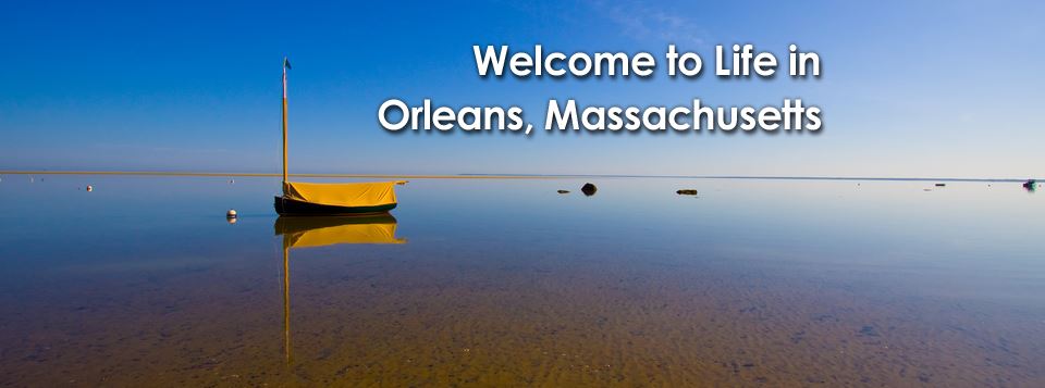
Orleans is a quaint seaside town that sits on the outer elbow of Cape Cod. The town is famous for its beaches, which are situated on both the wild Atlantic Ocean and calmer Cape Cod Bay.
Orleans was first settled in 1693 by Pilgrims from the Plymouth Colony who were dissatisfied with the poor soil and small tracts of land granted to them.
Originally the southern parish of neighboring Eastham, Orleans was officially incorporated in 1797.
Orleans was named in honor of Louis Philippe II, Duke of Orléans, in recognition of France’s support for the 13 colonies during the American Revolution, and because the town did not want an English name, as they had been captured twice by the British during the war.
Like much of the Cape, life in Orleans revolved around fishing, whaling and agriculture. As the fishing industry grew, salt works sprang up in the town to help preserve the catches.
However, the town’s growth helped deplete the town of lumber, a situation that did not begin to be remedied until the railroad came and brought lumber from the mainland in the mid-to-late 19th century. The rail also helped bring tourism to the town.
In 1898, the French Cable Company built a 3,200-mile-long (5,100 km) transatlantic cable to Orleans, which operated from the French Cable Station.
The town’s historical society is located in the 1834 Universalist Meeting House.
In July 1918, Orleans was shelled by a German submarine; the only attack on the continental U.S during World War I.
The town’s tourism industry was helped in 1961 with the creation of the Cape Cod National Seashore by President John F. Kennedy.
The natural beauty of Orleans’ shores and forests makes the town a perfect spot for a wide range of outdoor activities, including fishing, boating, swimming, biking and just plain relaxing in the clean, fresh air.
Surfing is popular at Nauset Beach, known for its expanses of white sand and its gentle waves. Skaket Beach has warm clear waters and tidal pools to explore; at low tide, you can walk for miles on the flats.
ORLEANS TRAILS
View our official Orleans community page at Orleans.MA.Life